Happy Trails
by Emily Grey, Contributing
Writer
Whether you�re traveling on a bicycle, a horse, or your own two feet,
the Virginia Creeper and New River Valley trails offer miles of scenic
exploration.
 Nestled in the spellbinding Southwest Virginia Blue Ridge Mountains are
two sweeping rough-cut emeralds, the Virginia Creeper and the New River
trails. Equestrians, naturalists, cyclists and cross-country skiers are
among the many groups that enjoy these multi-purpose tracts.
These ribbon-like greenways pass through federal, state and private
terrain. Landowners of the latter category graciously permit trail users a
right-of-way. This privilege naturally implies a two-way courtesy.
Crushed limestone and cinder facilitate cycling on the relatively level
surfaces of these rails-to-trails. Unexpected loose gravel, ruts and
gnarled roots demand the wide, knobby tires of a mountain or all-terrain
bike.
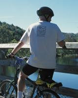
 Numerous, charming trestles of various lengths span beautiful lakes and
rivers. These little bridges are idyllic spots to dismount a bicycle and
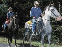
gaze into a seemingly lost horizon. Riders are expected to yield to
horseback riders, especially here.
Picnic benches, shelters, mileposts, comfort stations, kiosks and
historical exhibits are dispersed along these converted railroad beds and
old Indian routes. Treasure every precious, unhurried moment on these
hushed forested paths and be open to surprises.
Virginia Creeper Trail
�� the Creeper never fails to refresh the spirit and revive the
soul.� Frank Honeycutt, pastor, INTRODUCTION, The Virginia Creeper Trail Companion by Edward H. Davis and Edward
B. Morgan.
Day 1 (Whitetop Laurel to
Damascus � 17 miles)
Last October, amidst dancing golden leaves, migrating birds and nippy
morning air, this writer embarked on a cycling venture with companion, Tom
Horsch. Just outside the eastern trailhead to the north emerged the balds
of Whitetop, our state�s second-tallest peak. About face lay a lovely
pond with a beaver lodge straddling the surface. Hardy Fraser firs
triangularly dotted several Christmas tree hillside farms. At 3,600 feet,
this area is the Creeper�s zenith.
In close proximity are Mount Rogers National Recreational Area and
Tennessee. Jefferson National Forest encompasses much of the 10- to
12-foot-wide Creeper while the Appalachian Trail intersects the eastern
end.
Co-author of Mountain Biking the
Appalachians and an avid biker, my guide co-owns and manages the
Creeper Trail Cottages, Adventure Damascus and Tours, and Laughing Dog
Shuttle in Damascus. This Renaissance man cheerfully pointed out the
geology, history and natural features of his cherished passageway.
The initial train ran along this rail bed from Abingdon to Damascus in
1900. Several decades later, the �V-C� railroad was dubbed the
Virginia Creeper. No one really knows the etymology. Perhaps it was so
named because of the track�s intertwining course like the indigenous
vine. Creeping up and down steep grades and sharp curves likely factored
into the locomotive and trail�s appellation. In 1977, the final train
spent its passenger and timber-hauling course. In 1986, Congress
designated the Virginia Creeper a National Recreation Trail.
Several miles from the eastern onset is Green Cove Station, the only
original depot on the trail. Seasonal naturalists are often available to
answer questions and conduct informal tours at this appealing locality.
We continued our descent from 3,200 to 2,400 feet to enchanting Taylors
Valley. Wondrous rock outcroppings dressed the sylvan margins.
Beneath the assorted cobbles and boulders of Whitetop Laurel Creek,
said to be one of the state�s best fishing holes, are myriad hiding
places for trout. We watched small to mid-sized fish swim dauntlessly
about the clear stream. Beneath the trestle, children hopped over tiny
stepping stones in the shallows while their parents prepared a snack.
After treading down a steep bank, we paused to watch a whispering
cascade. Nuthatches, wrens and kinglets called from dense conifers. The
sun kissed sparkling rivulets and reticulating boughs of changing foliage.
It was one of those rare moments to savor.
Our magical journey ended too soon. Crossroads, vehicles and well-kept
homes signaled delightful, diminutive Damascus, �Gateway to the
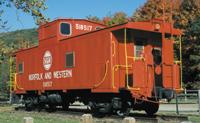
Trails� and the �Friendliest Trail Town.� A bright red caboose shone
in triumphant glory at Town Park.
DAY 2 (Abingdon to Damascus �
16 miles)
 On this Indian summer day, I was on my own. Considerably more joggers,
dog walkers and others use this leg of the Creeper.
A dormant ebony steam engine marked the western trailhead in Abingdon.
Splendid old oaks, winding pastures and mothers with strollers nodded as I
passed. In the spring, dainty wildflowers and a blush of rhododendron
decorate the track�s edges. Some of the 47 trestles rise over deep
jungle-like ravines.
The thunder of big rigs resounded from Interstate 81 as I pedaled
below. Rolling farmlands, old orchards, cattle, housing developments and a
golf course coexisted in an odd yet agreeable way. Several times I hopped
off my bike to open and shut swinging gates on private lands.
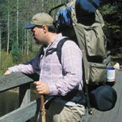 I heard the roar of rapids while approaching Alvarado, the trail�s
lowest point at 1,750 feet. Limestone cliffs beamed across the confluence
of the Holston River�s South and Middle Forks and Holston Lake.
Mileposts 16 � 17 led me to charming, familiar Damascus. I returned my
bike to Tom�s rental and shuttle service, also known as the town�s
unofficial chamber of commerce.
The Virginia Creeper Trail is a benevolent partnership of devoted
volunteers, the U.S. Forest Service and the communities of Abingdon and
Damascus. During the horrific ice storm of 1999, the Virginia Creeper
Trail Club (www.vacreeper.org) and others worked feverishly to clear trees
and debilitating debris off their beloved path in just two weeks!
The New River Valley Trail
At 350 million years old, the New River is second in antiquity only to
the Nile. It is one of the few North American rivers that flows north. The
57.5-mile rail-trail that embraces Grayson, Carroll, Wythe and Pulaski
counties and the City of Galax intertwines through urban centers and
pastoral wilderness and can be entered via at least a dozen points. The
New River parallels its companion 10- to 12-foot-wide trail for about 39
miles.
The original Cripple Creek line (later called the Norfolk and Western)
ferried iron and lead from area mines to industrial centers in the late
1800s. The Norfolk Southern Corporation donated this abandoned railroad
right-of-way to the state. Like the Virginia Creeper, this haven is part
of the nation�s Rails to Trails Program.
DAY 3 (Fries to Fries Junction
� 5.5 miles)
Shady upland woods, tiny cascades and palisades along the river set the
stage for adventure on this wildest part of the trail. A familiar
spine-tingling screech sounded far above the swirling water and rocks. An
adult and an immature bald eagle graced the crystalline sky and quickly
disappeared to a more promising fishing hole. Several miles later a beaver
peered from a brushpile and waddled away into the forest.
 I often paused for long periods to peer over the river as it swiftly
poured over jagged rocks. Glistening gold-spun leaves framed portraits of
barns, country homes and roaming farm animals on the opposite bank.
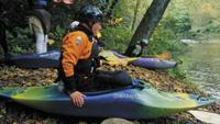
Only 12 humans, including park rangers, shared this tract with me. Low
water on this day lured only two kayakers. Fries Junction, with picnic
facilities and a 1,089-foot trestle, is a popular respite at the tip of
this line.
DAY 4 (Galax to Foster Falls �
26 to 28 miles)
This second-wildest stretch commences at Cliffview Ranger Station or
Galax Trailhead off State Route 58. Most people travel Pulaski to Foster
Falls and this section.
Chestnut Ridge Falls contains a babbling waterfall, short trestle and
access to the Appalachian Trail. Two brief tunnels heighten the rustic
aura of the old train course.
This section of the trail culminates in the historic Village of Foster
Falls. Located there are the park�s administrative offices, a riverside
campground, a restored railroad station, and a former orphanage built upon
a knoll.
Close by is Austinville, touted as North America�s oldest
continuously operated (lead) mine. Also near is the 75-foot-high,
200-year-old stone Shot Tower, a National Historical Mechanical
Engineering Landmark. The tower was used to fashion uniform shot for
frontier hunters and later for the Confederacy. Shot was formed by
dropping molten lead down a deep shaft. Today, an
incessant vehicular rumble is detected overhead on I-77.
DAY 5 (Pulaski to Foster Falls
� 24 miles)
Much of this segment traverses private properties and shadowy timbers.
Warblers, northern cardinals and mockingbirds vocalized, invisible in the
brush.
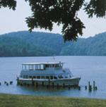
Several long trestles afforded heavenly views of Claytor Lake. Dazzling
mountain backdrops tugged at my heart strings.
Small powerboats planed over the placid water. Families, couples and
college groups watched fishermen cast for smallmouth bass. Walleye and
muskellunge are also caught here.
 Stately homes and a snow-white church graced the community of Allisonia
Station, now a guest cottage. A vending machine provided cold drinks to
passersby. A family, formerly from the Carolinas, summoned me to their
porch for a soda and talked about the tempo of the trail.
�Most folks along this route are friendly,� said Rupert Bowen, my
host. �And, the New River is so lucid and pure that people often go
snorkeling there.�
A small footbridge just off the path tempted me to linger. Carefree
youngsters waded and swam in the chaste water hole on this gorgeous fall
day. A father, uncle and son rested against an enormous log while
beholding the beauty of the riparian environment.
A few more miles and the familiar arena of Foster Falls beckoned. I
coasted gleefully down the hill past the sprawling rustic fences and
stables to the bike rental and shuttle service.
The Virginia Creeper and New River Trails are wonderful sites to
regroup and rejoice with the natural world. They left me with a yearning
to return again. The other trail users I met on my journey appeared to
share this sentiment.