Driving Virginia
by Emily Grey, Contributing Writer
 Hop in for a
motor tour of the Commonwealth’s most scenic backroads and byways.
The Commonwealth is an intriguing mix of early history, changing topography and natural
beauty. None of the other 48 states this writer has visited quite matches the package deal
of the mother of them all.
According to a recent Virginia Tourism Corporation (VTC) study, motoring closely trails
walking as the chief means of enjoying the Old Dominion. So it seems appropriate to
explore some blue highways. "Shunpiking" off major thoroughfares allows a driver
and passengers to unwind and immerse themselves in the true essence of a region.
After journeying thousands of miles throughout Virginia, I chose the 10 most entrancing
drives along with an honorable mention. Criteria for my selections include diversity,
accessibility, geography, spectacular scenery and minimal congestion. I also mention
special attractions along the way.
Autumn’s gorgeous, bold colors and crisp, invigorating air incite people to heed
mystical callings. Why not take a leisurely spin across Virginia’s stunning roads
less traveled? With all that said, here is my list in no particular order.
1 - BLUE RIDGE PARKWAY
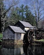 America’s
most illuminating path stretches over 200 toll-free miles in Virginia from Rockfish Gap
near Waynesboro to North Carolina. From kaleidoscopic fall foliage to brilliant spring and
summer wildflowers, nature unveils a remarkable show. (The road is closed during inclement
winter weather.) Numerous overlooks and exits to regional attractions are designated by
mileposts and signs.
Gristmills, split-rail fences and pioneer cabins allow visitors to experience the
modest origins of this great country. Apple orchards, fields, forests, rocks and stalwart
mountains are therapeutic to the senses and soul. For a short, meaningful excursion, trek
up to Humpback Rocks at mileposts 5 – 9.3.
At Milepost 27, take Route 56 to captivating Crabtree Falls by the Tye River and
observe the state fish hatchery at Montebello. Fifteen miles off the parkway at Milepost
61.6 or 63.7, meander over to the 90- to 100-foot-wide Natural Bridge, revered by the
Monacan Indians and surveyed by George Washington. Sometime later, at Milepost 176.1,
examine Mabry Mill, the most photographed site on our nation’s cherished parkway.
2 - SKYLINE DRIVE
(Shenandoah National Park)
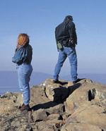 Ascending
from the Blue Ridge Parkway is a wondrous road from Waynesboro to Front Royal. The
approximately 105-mile-long Skyline Drive and its companion Blue Ridge Parkway are our
nation’s longest, slowest and most beautiful rides. It is interesting to compare
wildlife sightings and vegetation as it blossoms at distinct times in the two locales. To
eschew fall and weekend crowds, it is wise to travel on weekdays and always make advance
reservations.
Shenandoah National Park has varied interpretive programs about indigenous biota,
geology and natural history. Assorted family activities include horseback riding, camping
and playground exercise. Around 500 miles of engaging hikes and 75 turn-offs furnish
endless vantages of cascades, rivulets, forests and mountains. Keep alert for the
ubiquitous white-tailed deer.
3 - FORT VALLEY ROAD
(Route 678)
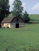 Fill your
gas tank before this journey. Route 675 (Mechanic St.) from Luray leads an adventurer on
an unexpected frolic into Fort Valley Road (Route 678). This playful, narrow byway zigzags
nearly 30 miles around farms, verdant hillsides and George Washington National Forest. It
is easy to see why this clandestine course is a favorite among motorcyclists.
About four miles past Camp Roosevelt, turn right onto 675 and veer left after another
mile onto South Fort Valley Road. Stables, expansive countryside and colorful wildflowers
decorate most of this isolated route with distant summits on all sides. Eventually, a
diminutive library, country store and churches emerge in a vicinity called Water Lick.
Elizabeth Furnace Recreational Area with picnic facilities and supreme isolation marks the
end of this challenging stretch.
Return to Luray via scenic Route 340 South and stop at lovely Shenandoah River (Guest)
State Park. Or, take Route 11 South at Strasburg, an antique mecca, and loiter at charming
towns and New Market Battlefield Historical Park. No tour of this venue is complete
without including the famous Luray Caverns off Route 211.
4 - ROUTE 42
(Dayton to Goshen) & ROUTE 39 (Goshen to Lexington)
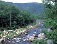 The northern
tip of Route 42 encompasses Mennonite barns, silos and farmhouses from yesteryear. Lush,
sprawling livestock pastures and cropfields, reminiscent of Pennsylvania Dutch villages,
also frame this unlikely Virginia countryside. Learn about the region’s rich heritage
and survey precious folk art displays at Dayton’s Shenandoah Valley Folk Art and
Heritage Center. Or, purchase "tiques and toys" or goodies at the local
farmers’ and artisans’market.
Natural Chimneys near Bridgewater are a septet of medieval-looking limestone towers.
Close by is spring-fed Mossy Creek, one of the state’s finest caches of brown trout.
Quiet woods, cushiony meadows and tiny burgs like Buffalo Gap adorn the remainder of 42 to
the railroad Town of Goshen, about 50 minutes from Dayton.
Along Route 39 is Goshen Pass, an astounding three-mile gap through the Allegheny
Mountains. After a hiker gingerly crosses a wooden suspension bridge, the Maury River
soothingly invites her to linger on the rocks and behold fragrant joe-pye, royal fern and
native songbirds. Or, one may climb sylvan trails and peer down from 3,000-foot-high
vistas.
A few miles east past the appealing little village of Rockbridge Baths and the Virginia
Horse Center is historical, architecturally attractive Lexington. This home of VMI and
Washington and Lee University is a splendid place to stroll and dine. Distance from Goshen
to Lexington on Route 39 is 19 miles.
5 - ROUTE 220
(Monterey to Martinsville — at Roanoke veer onto I-581 South and follow signs to 220
South)
 Remote,
ruggedly gorgeous Highland County touches the sky with four mountain chains: the
Shenandoahs, Blue Ridge, Appalachians and Alleghenies. The headwaters of the Greenbrier,
Potomac and James and the lesser known Bullpasture and Cowpasture rivers offer excellent
angling and wildlife watching opportunities. The county seat of Monterey and surrounding
pastoral felicity of Virginia’s "Little Switzerland" provide endless
panoramas.
Charming Bath County provides a heavenly respite of mineral springs. There are Warm,
Hot and Healing springs and the renowned Homestead Resort. While passing through
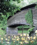
Covington, check out Virginia’s oldest intact covered bridge, the Humpback, just off
Route 60. Fenwick Mines, near Fincastle, contains pleasant boardwalk wetland trails
designed for handicapped individuals. Route 220 from Monterey to I-581 in Roanoke is about
120 miles. From I-581 to Route 220 south of Roanoke is about 10 miles.
Route 220 south of Roanoke rewards the traveler with imperial hills, far-off pinnacles
and relatively low traffic. Off Route 122 near Rocky Mount is the enticing Booker T.
Washington National Monument, which features farm animals, costumed interpreters and
tranquil woodlands. Near the Carolina border at Martinsville, be sure to visit the
Virginia Museum of Natural History. It’s about 60 miles from Roanoke to Martinsville.
6 - ROUTE 58
(Abingdon to Cruzes Store)
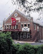 Abingdon, the
oldest incorporated city west of the Blue Ridge and home of the famous Barter Theatre, is
an enchantingly artsy, historical and gourmand haven. Friendly people, unusual Appalachian
crafts and an outdoor wonderland invite one to linger a little longer at this destination.
If ever an earthly paradise were created then surely it must lie within Grayson County.
The Commonwealth’s two highest peaks, Mt. Rogers and Whitetop, and Grayson Highlands
State Park and the beloved Virginia Creeper Trail are extraordinary.
Mountain cyclists, horseback riders and musicians are drawn to the pristine aura of
Galax. Route 58 continually entertains with a visual feast of knobs, rivers and serene
backcountry past the Blue Ridge Parkway to Route 8. Nearby Fairystone State Park is a
fitting way to temporarily close this magical path. It’s about 130 miles from
Abingdon to Cruzes Store.
7 - ROUTES 80, 83 & 23
(Breaks Interstate Park to Norton)
 "The
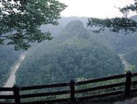
Grand Canyon of the South" exhibits an approximately five-mile-long, 1,600-foot-deep
sheer rock tower called the Breaks. Many years ago the Russell Fork sculpted (and
continues to sculpt) this deepest gorge east of the Mississippi River. Virginia and
Kentucky share this natural wonder which served as a path for the Shawnee Indians and
Daniel Boone and today hosts water sports, woodsy outings, gospel groups and conferences.
The Clinchfield (CSX) Railroad, once a vital link between the southeast Atlantic coastal
states and the Ohio Valley, still whirs through the chasm.
On October weekends, whitewater rafters, kayakers and canoeists from all over America
ride up to Class VI rapids on the John W. Flannigan Dam and Reservoir just south of the
Breaks. At the southern end of Route 83, the North Fork Reservoir at Pound creates
additional aquatic recreation.
Route 23 through Wise County is a curious serpentine passage by active coal mines, big
rigs and quaint little communities. (Hold off during morning fogs until this fleeting
condition abates.) This forested route is a favorite among birders. From the observation
tower at High Knob off Route 619, one can distinguish five states and manifold wildlife
species including raptors and neotropical songbirds. Breaks Interstate Park to Norton is
about 50 miles.
8 - BURKE’S GARDEN
(Routes 19/460 at Tazewell to Routes 61 & 623)
 Cradled
in the heart of Tazewell County is a bewitching place. Not every savvy traveler is aware
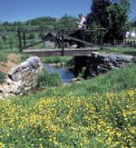
of Virginia’s largest rural historical district and national landmark, a gigantic
bowl in the earth left by the forces of geology and time.
While standing in the massive valley one can actually sense a chilling effect as if an
invisible, mischievous force were at work. Almost as remarkable is the vista from the
gritty mountainous road, which encircles the ridgeline of the garden and allows the driver
to pause and gaze at the exceptionally rich farmland below. One can also hike a portion of
the Appalachian Trail along this upper route. Do not leave the area without a visit to
Burke’s Garden General Store for sandwiches or mementos.
To or from Burke’s Garden, stop in at the Historic Orchard Museum and Pioneer Park
in Tazewell. This desolate section of the state grants leisurely speeds past extensive,
undeveloped verdant acres. Much of the land in this area is still owned by heirs or
families of bygone generations. No landowner would sell mogul G.W. Vanderbilt a parcel of
Burke’s Garden in the 1880s. From the Town of Tazewell, Burke’s Garden is about
20 miles.
9 - NORTHERN NECK
(Route 3 at Greys Point to 200 N & 360 E to Reedville, Backtrack 360 W to 202 N &
3 W to Oak Grove)
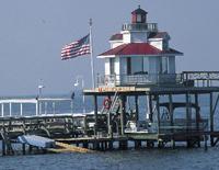 Moseying
about the Northern Neck is tantamount to reliving its early and recent history. Auction
houses, old country stores and fetching nautical gift shops crop up periodically along
this rustic trail. Old and contemporary homes embellished with colorful flower beds also
shape this unhurried avenue.
After crossing the Rappahannock River at Greys Point, follow signs to Windmill Point, a
poignant Civil War venue. The fishing hamlets of Reedville and Fleeton are just minutes
from the seasonal passenger ferries to Maryland’s Smith Island and Virginia’s
Tangier Island. For a 15-minute diversion, board the free, cable-drawn three-car Sunnybank
ferry and drift to the tiny shore of Ophelia and back. Off Route 202 lies the enticing
port of Kinsale engulfed in a sea of splendid yachts.
Pope’s Creek and Stratford Plantations, the respective birthplaces of George
Washington and Robert E. Lee, afford amazing sweeps of the Potomac River and the
neighboring Maryland shore. Westmoreland State Park is also an educational and
entertaining way to investigate this vast history land. Oak Grove’s Ingleside Winery,
the final stop, presents an opportunity to tour the vineyards and taste healthful vintage.
Total distance of this tour is about 120 miles.
10 - COLONIAL PARKWAY
(Yorktown to Williamsburg & Jamestown) and ROUTE 5 (James River Plantations)
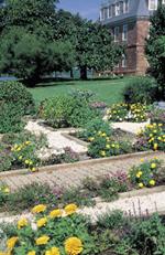 This
culturally enriching, aesthetically pleasing course symbolizes our nation’s beginning
to its independence. From I-295 South near Richmond, enter 30-mile-or-so Route 5 into
Charles City County, a surprising expanse of greenery minus strip malls, noisy industries
and excess denizens. This imposing fairyland showcases magnificent, well-kept plantations,
some with majestic views of the romantic James River. Sometimes, Civil War re-enactments
unfold on spacious rolling lawns.
Route 5 hooks up via Route 199 to the Colonial Parkway, or turn onto Greensprings Road
and follow signs to the Jamestown Settlement. Three famous ships, Discovery, Godspeed and
Susan Constance, and America’s original "living" colony are festively
exhibited at Jamestown. While in the area, a tour of Colonial Williamsburg is a must for
ghost lovers, history buffs and other lifelong scholars.
The 27-mile Colonial Parkway is a glorious passage beneath wide brick arches, over
short bridges, past sandy beaches and a weapon station to the Yorktown Battlefield and
Victory Center. It is also an ultimate location to watch for nocturnal creatures.
Honorable Mention: Route 600
(Seaside Road)
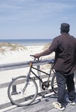 Less than a mile
from the Chesapeake Bay Bridge Tunnel tollgate is a relaxing way to discover the southern
Delmarva Peninsula. Preserved WW I and II bunkers and lookouts and nature walks,
observatories and a visitor center at the Eastern Shore of Virginia National Wildlife
Refuge help orient the wayfarer to the region. Watch out for cyclists, farm machinery and
horseback riders along this constricted rural passageway.
The seaside villages of Oyster, Willis Wharf, Quinby and Wachapreague pique a
mountaineer’s and city dweller’s curiosity. Maplewood Gardens’ nurseries
and woodland trail create a welcome sanctuary.
While in the area, it is worthwhile to visit Chincoteague from Route 13 to 175 east.
Fall is an ideal time to wander along the vast wind-swept Atlantic beach and enjoy the
solitude of my peaceful homeland. The Seaside Road is about 50 miles.
Interested?
For a free Virginia Travel Guide, call (800) VISIT-VA and browse VTC’s http://www.Virginia.org. (Ask about the Scenic Roads in
Virginia map.)
For specific information on roads and maps, contact Virginia Department of
Transportation (VDOT) at (804) 786-2838. (To inquire about travel conditions during
unfavorable weather, highway incidents or work zones, phone VDOT’s 24-hour HIGHWAY
HELPLINE at (800) 432-7623 or for TTY users (800) 432 -1843.)
Check out author Emily Grey’s new Web site at www.ecoscapeimages.com. She may
be e-mailed at [email protected].